Beautifully wooded
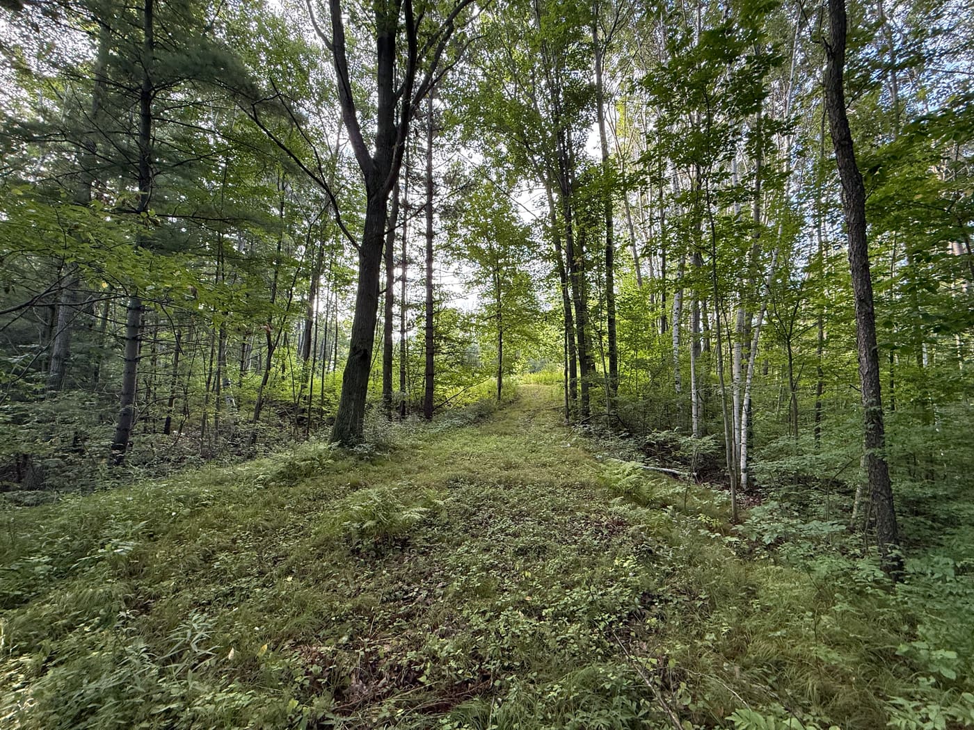
Oak, cherry, poplar and maple throughout, with mature pines providing substantial privacy from the road and neighboring lots.
For Sale by Owner · Brown County, Wisconsin
For sale by owner in the desirable Hobart / Oneida area — wooded, surveyed, and ready to build.
444 Oak Ridge Drive, Hobart, WI 54155
$225,000
The Property
Combining privacy and convenience, this buildable lot is 2.68 acres located on a quiet cul-de-sac road, in the desirable Hobart/Oneida area.
Oak, cherry, poplar, and maple trees exist throughout this beautifully wooded lot, with mature pines providing substantial privacy from the road and neighboring lots. A sloping ridge leads to Trout Creek running through the back of the property, creating scenic views and serene ambiance.
This lot is also conveniently located near the Hobart Centennial Center, and is within the Pulaski school district.
A certified survey map, a building envelope, and a soil evaluation showing the soils as suitable for a septic system are all available to download on this page. The building envelope has been cleared for excavation, and a stone apron has been installed at the front of the property.
Why this lot
Oak, cherry, poplar and maple throughout, with mature pines providing substantial privacy from the road and neighboring lots.
A sloping ridge leads down to Trout Creek running through the back of the property, creating scenic views and a serene ambiance.
The certified survey map and the building envelope exhibit are both on this page to download. The envelope is cleared for excavation and a stone apron is installed at the road.
A completed soil evaluation shows the soils as suitable for a septic system — one of the biggest unknowns on raw land, already answered.
A quiet cul-de-sac road in the desirable Hobart/Oneida area, minutes from the Hobart Centennial Center.
Located within the Pulaski Community School District.
Photo tour
40 photos · tap any image to enlarge
Location
444 Oak Ridge Drive, Hobart, WI 54155 · Parcel HB-640-12
Boundary shown is approximate, drawn from Brown County GIS records. The certified survey map is authoritative and is available to buyers. Switch the map to satellite view to see Trout Creek at the back of the lot.
Details
| Address | 444 Oak Ridge Drive, Hobart, WI 54155 |
|---|---|
| Acreage | 2.68 acres (117,170 sq ft) |
| Parcel ID | HB-640-12 |
| Tax key | J16484-10 |
| Legal description | Lot 1, Certified Survey Map 9252 |
| Zoning / use | Residential — buildable lot |
| Survey | Certified survey map (CSM 9252) — free to download below |
| Building envelope | Defined and cleared for excavation — exhibit free to download below |
| Septic | Soil evaluation shows soils suitable for a septic system — report free to download below |
| Site access | Stone apron installed at the front of the property |
| Water feature | Trout Creek runs through the back of the property |
| Timber | Oak, cherry, poplar and maple, with mature pines along the road |
| School district | Pulaski Community School District |
| County | Brown County, Wisconsin |
| Listing type | For sale by owner |
Information is believed to be accurate but is not warranted. Buyers are encouraged to verify all details, including acreage, boundaries, zoning, permitted use and utility availability, with Brown County and the appropriate municipal authorities. This property is offered for sale by the owner.
Due diligence
Every document the owners hold on this lot — read them in your browser or download a copy. No form to fill in first.
3 documents · free to download


Aerial exhibit
An aerial exhibit showing the building envelope — the buildable ground, already cleared for excavation, measuring 81′ to 129′ across and bounded by the steep-slope limit to the west and the 20′ steep slope ESA to the north. It was drawn before the survey was recorded, so its lot outline runs further north than the recorded 2.68 acres; the envelope itself is unaffected.

Copies are reproduced as received from the surveyor and soil tester. The certified survey map recorded with Brown County is the authoritative boundary; buyers should verify these documents with the county and the Village of Hobart before relying on them.
Get in touch
Questions about the survey, the soil evaluation, the building envelope, or scheduling a walk of the property — send a note and the owner will get back to you directly. No agents, no pressure.
Or call / text
(920) 228-6287